Introduction
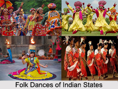
India is singly noted for the vast scope of culture, tradition and also geographical variations, climatic conditions and demography. India is one country that smoothly and evenly divides itself into states and union territories, as states the Preamble of Indian Constitution that the country is a ‘sovereign, socialist, secular, democratic, republic.’ The states and territories are themselves additionally sub-divided. The umpteen and mind-boggling class of people, with their religious beliefs, differentiated way of living, a separate cooking style or way of dressing, no other country has never been such diversification personified, like India is. For example, the north-eastern states differ vastly from the states situated in south-western.
The eight union territories again possess a distinct flavour and redolence of their own, some times metropolitan and at times topped with tinges of ruralism. Each of the twenty-eight Indian state and eight union territory resides side-by-side in a disciplined manner, with an amalgamation and overlapping of cultural and educational thoughts every now and then. Although India is divided into states and union territories, the country is essentially ruled in a parliamentary system of democracy.
Creation of Indian States and Union Territories
Indian sub-continent has been governed by numerous diverse ethnic groups throughout its history, each enforcing their own administrative policies on the region. Present India`s existing administrative divisions are reasonably recent creations, which began to develop during British colonial rule over India. During this period, the colossal regions of India were either directly ruled by the British or under dominance of local rajas. Independence in 1947 predominately maintained these divisions, with the provinces of Punjab and Bengal being fractioned between India and Pakistan.
Following independence, imbalance slowly became the order of the day. Racial and cultural tensions egged on the Indian Parliament to restructure the country on racial and linguistic lines in 1956. Thus began the historic creation of Indian states, together with union territories.
The erstwhile French and Portuguese colonies in India were comprehended into the Republic as the union territories of Pondicherry, Dadra, Nagar Haveli, Goa, Daman and Diu in 1962. Numerous new states and union territories have been created out of existing states from 1956. Bombay State was divided into the linguistic states of Gujarat and Maharashtra on 1 May 1960 by the Bombay Reorganization Act. Punjab Reorganization Act of 1966 split Punjab on linguistic and religious lines, creating a new Hindu and Hindi-speaking state of Haryana, channelising the northern districts of Punjab to Himachal Pradesh and denominating Chandigarh, the mutual capital of Punjab and Haryana, a union territory.
Nagaland was declared a state in 1962, Meghalaya and Himachal Pradesh in 1971 and Tripura and Manipur in 1972. Arunachal Pradesh was declared a union territory in 1972. Kingdom of Sikkim united with the Indian Union as a state in 1975. Mizoram was declared a state in 1986 and Goa and Arunachal Pradesh in 1987. Goa’s northern parts of Daman and Diu turned a separate union territory. In 2000, three new states were created; Chhattisgarh (November 1, 2000) was created out of eastern Madhya Pradesh, Uttaranchal (November 9, 2000), afterwards renamed Uttarakhand, was created out of the hilly areas of northwest Uttar Pradesh and Jharkhand (15 November 2000) was created out of the southern districts of Bihar. The Union Territories of Delhi and Pondicherry (renamed to Puducherry) have later been given the right to choose their own law-makers and they are since looked at as small states.
Division of Indian States According to Geographical Zones
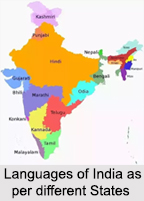
All the states of India are grouped into six major geographical zones based on their location. These zones, designated under the Zonal Council system, created by the States Reorganisation Act of 1956, aim to promote inter-state coordination and regional development.
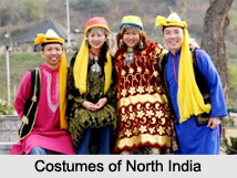
North Indian states:
The Northern region of India includes the states of Himachal Pradesh, Punjab, Uttarakhand, Haryana, Rajasthan, and Uttar Pradesh, along with the Union Territory of Delhi. Additionally, the Union Territories of Jammu & Kashmir, Ladakh, and Chandigarh are also considered part of North India.
West Indian states:
Western India comprises the states of Goa, Gujarat, Maharashtra, and Rajasthan, along with the union territory of Dadra and Nagar Haveli and Daman and Diu. This region is notably marked by a high concentration of urban centers.
East Indian states:
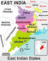
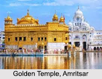
The Eastern region of India includes the states of Bihar, Jharkhand, Odisha, and West Bengal, in addition to the union territory of the Andaman and Nicobar Islands.
South Indian states:
Southern India, also known as Peninsular India, refers to the southern part of the Deccan Plateau. It includes the states of Andhra Pradesh, Karnataka, Kerala, Tamil Nadu, and Telangana, along with the union territories of Puducherry and Lakshadweep.
Northeast Indian states:
The Northeast region of India consists of eight states: Arunachal Pradesh, Assam, Manipur, Meghalaya, Mizoram, Nagaland, Tripura, and Sikkim. The first seven are commonly called the "Seven Sisters," while Sikkim is affectionately known as the "Brother."
Central Indian states:
Central India includes the states of Madhya Pradesh and Chhattisgarh. Positioned at the heart of the country, these states are recognized for their rich cultural heritage, varied landscapes, and historical significance. Among the two, Madhya Pradesh is the larger, with Chhattisgarh occupying a smaller area.
List of Indian States and Union Territories
Indian states and union territories have since independence been declared as unified whole, setting apart ethnic differences and governing in a disciplined mode of administration. The states follow a specific kind of rule, with union territories being governed in a rather extraordinary manner. A union territory, defined as the "sub-national administrative division of India", is directly ruled by the Federal National Government. They are hence under the domination of direct administration and control of the federal government of India. The President of India nominates an Administrator or Lieutenant Governor for each territory. At present there exists twenty-eight states and eight union territories in Indian administration. They can be uniformly listed as follows:
List of Indian States
List of Union Territories: